The Ground Was Never Empty: Kentucky History You Can Still See
The Ground Was Never Empty: Kentucky History You Can Still See
I live in Shelby County. The green-and-gold markers are part of the scenery here the way church steeples and tobacco barns are. I wrote about the marker program already — how a private club started it, how Walter Wentworth pushed it into all 120 counties, how you search the database. This is not that post.
This is what the plates are pointing at.
The signs around the square in Shelbyville will tell you this county was cut from Jefferson in 1792 and named for Isaac Shelby. They will point you two and a half miles north to Squire Boone’s station on Clear Creek. They will not tell you that Shawnee women were boiling salt at the springs around the future Harrodsburg before any of those men drew lots for cabin lots. They will not tell you that Kentucky became a commonwealth without the far west, because Chickasaw title was not extinguished until 1818.
I wanted the stories. Native and pre-commonwealth Kentucky. How the towns were pinned to water and salt and a river choke point. And then a list I can actually drive: the courthouse cluster first, then west on U.S. 60.
Kentucky became a commonwealth in 1792. Almost everything that follows happened before that, or explains why the empty-hunting-ground story was never true.
Dark ground
In March 1775, at Sycamore Shoals on the Watauga, Richard Henderson tried to buy Kentucky from more than a thousand Cherokee. He wanted a fourteenth colony. He called it Transylvania. Dragging Canoe, Attakullakulla’s son, would not sign. He told the buyers the country was already spoken for, that a dark cloud hung over it, that it was bloody ground and would be hard to settle. He walked out, took his followers to the Chickamauga towns near present Chattanooga, and spent the rest of his life raiding the roads Henderson and Boone had opened, including Boone Trace into Kentucky. The myth named after his warning erased the people he was trying to warn about.
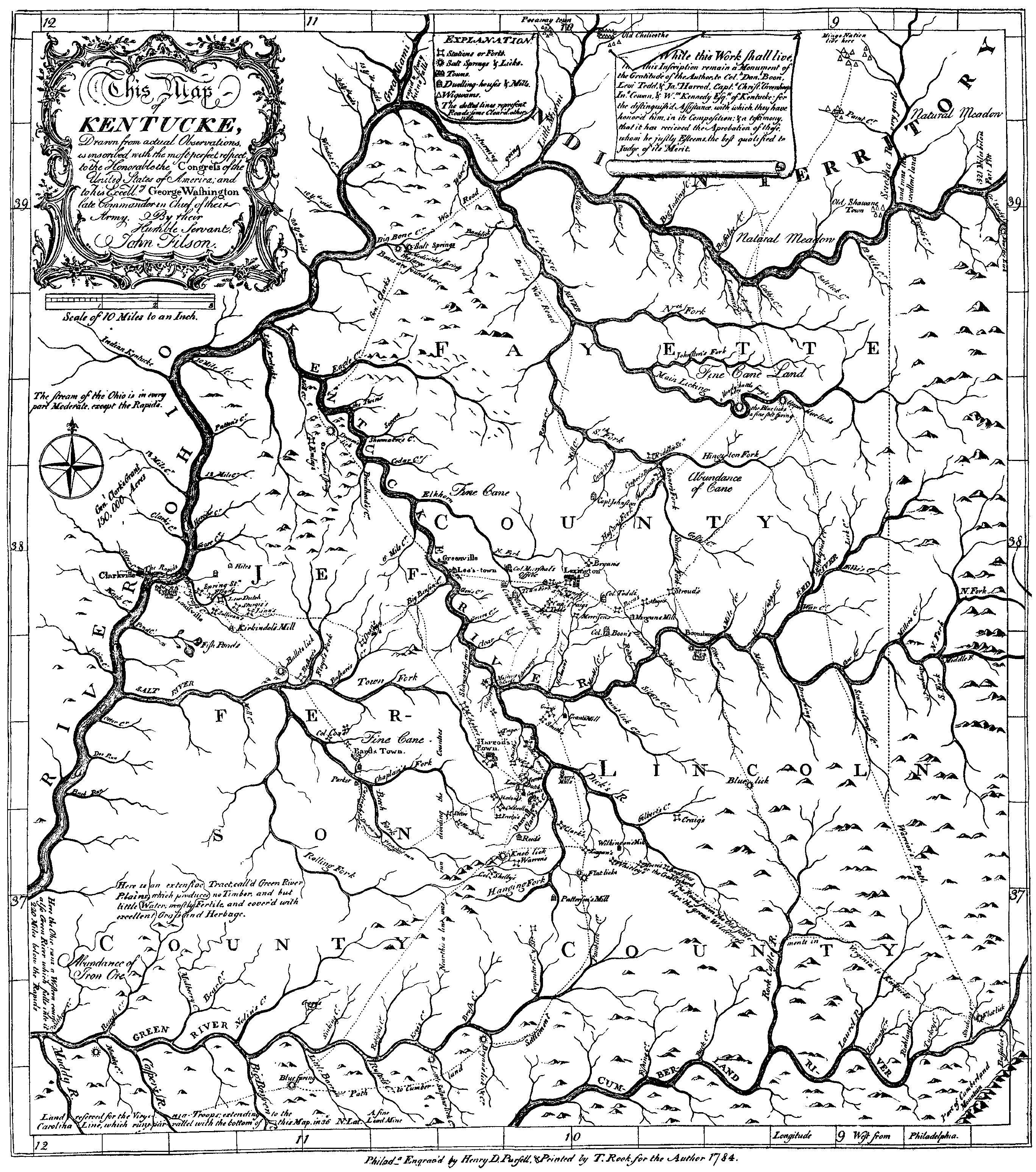
Speculators and, later, Kentucky’s first historian, John Filson, turned that warning into a claim that “Kentucke” meant “Dark and Bloody Ground,” that no nation had ever really lived there, and that the land was therefore free for the taking. The name Kentucky does not mean that in any language. Archaeologist A. Gwynn Henderson traces the myth to Filson’s 1784 book The Discovery, Settlement, and Present State of Kentucke, which twice called the country the “Dark and Bloody Ground” and a “theater of war.” If Kentucky was only a hunting ground, land companies could sell it and settlers could fence it. Dragging Canoe’s exact wording does not survive in a treaty transcript. The warning is real. The famous phrase is partly Filson’s.
John Filson’s 1784 Map of Kentucke. Look for stations, the Wilderness Road, and “Old Shawnee Town” on the Ohio. Public domain, 1784. (Wikimedia Commons )
Reality was messier, and more inhabited. Shawnee people claimed much of what is now Kentucky and used it with Cherokee, Mingo, Tutelo, and others. Shawnee women boiled salt at the springs around the future Harrodsburg — salt was money. The last well-documented Native town inside the future state, Eskippakithiki (“place of blue licks”), sat on the Warrior’s Path in present-day Clark County from about 1718 to 1754: a palisaded village of perhaps two hundred families, cornfields on a 3,500-acre plain later nicknamed Indian Old Fields. By the time Daniel Boone looked out from nearby Pilot Knob in 1769, the Shawnee of Eskippakithiki had already been pushed north of the Ohio. They did not vanish. Marker 1274 , Indian Old Fields, stands about eleven miles southeast of Winchester on KY 15. You can stand at the marker. You cannot walk a reconstructed palisade.
Chickasaw people held the far west as hunting ground under the 1786 Treaty of Hopewell. Kentucky became a state in 1792 without that land. The Chickasaw title was not extinguished until October 19, 1818, when Andrew Jackson and former governor Isaac Shelby signed the Treaty of Tuscaloosa, the Jackson Purchase.
People farmed here for centuries. In the mid-1700s many farming towns had shifted north of the Ohio. That is not the same as empty. Filson’s map still labels “Old Shawnee Town” on the Ohio.
Catahecassa — Black Hoof — was Mekoche Shawnee, later head civil chief of the Ohio Shawnee. Clark County tradition ties him to Eskippakithiki and says he visited the old fields in 1816. Birth at the town is often repeated and not proven. Treat the birthplace as tradition.
The hills that are not hills
Five thousand years before Harrod’s men drew lots for cabin lots, families on the Green River were burying their dogs. Indian Knoll, a Late Archaic shell midden in Ohio County, occupied mainly about 3000–1000 BC, is a heap of freshwater mussel shells, hearths, and graves. University of Kentucky crews working for the WPA in the late 1930s recovered hundreds of human burials and 23 dog burials. Some dogs had graves of their own. Some were laid with adults or children. The “empty” woods were already a cemetery, a fishery, and a planned seasonal home. The Kentucky Archaeological Survey page is the place to start.
Later people stacked earth on purpose. Adena communities of the Early–Middle Woodland, roughly 500 BC–AD 200 in the Bluegrass, built burial mounds and geometric enclosures. At Mount Horeb, on a bank above Elkhorn Creek near Lexington, they raised a circular platform about 105 feet across, ringed by a ditch and a low wall. In 1939 William S. Webb’s WPA crew found the postholes of a timber circle: 132 posts, about 48 feet across — a wooden ceremonial building that had vanished into the soil. Mount Horeb sits in what is now Adena Park.
Then the farmers. Fort Ancient people, about AD 1000–1750, lived in circular villages of corn, beans, and squash. At Fox Farm, a ridgetop in Mason County occupied from about 1300 to at least 1650, houses started as a ring around a plaza. Fort Ancient towns were still on the landscape when Europeans arrived. That is the missing chapter between “moundbuilders” and “Shawnee hunting ground.” Fox Farm is in the Survey’s site list.
In the far west, Mississippian farmers founded Wickliffe around AD 1100 on a bluff over the Ohio. They built platform mounds A and B, a plaza, houses, and, after 1175, a cemetery mound that may have held as many as 900 people. By 1350 the community capped its mounds and left. The town had lasted about as long as the United States has so far.
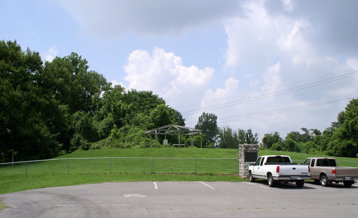
Mound A at Wickliffe, Ballard County. Photo: Herb Roe, 2011, CC BY-SA 3.0 .
The twist is that the mounds are the towns — planned, rebuilt, abandoned — and that the ground was already towns and cemeteries long before Boonesborough.
Springs, fords, and a dead man’s crossing
Towns in early Kentucky were pinned to water, salt, a river choke point, or a land company’s map.
Harrodsburg began at a spring. Shawnee women had already used the salt springs here. On June 16, 1774, James Harrod and about thirty-one men laid off Harrodstown along the “town branch” at Big Spring in present Mercer County. Cabins were assigned by lottery, clustered around the water. Lord Dunmore’s War emptied the clearing within a month. Harrod returned on March 15, 1775. Fort Harrod went up on the hill west of the spring. By 1776 it was the seat of Virginia’s new Kentucky County. Marker 1449 , The Big Spring, sits behind Harrodsburg High School: the never-failing spring chosen as the reason for the town.
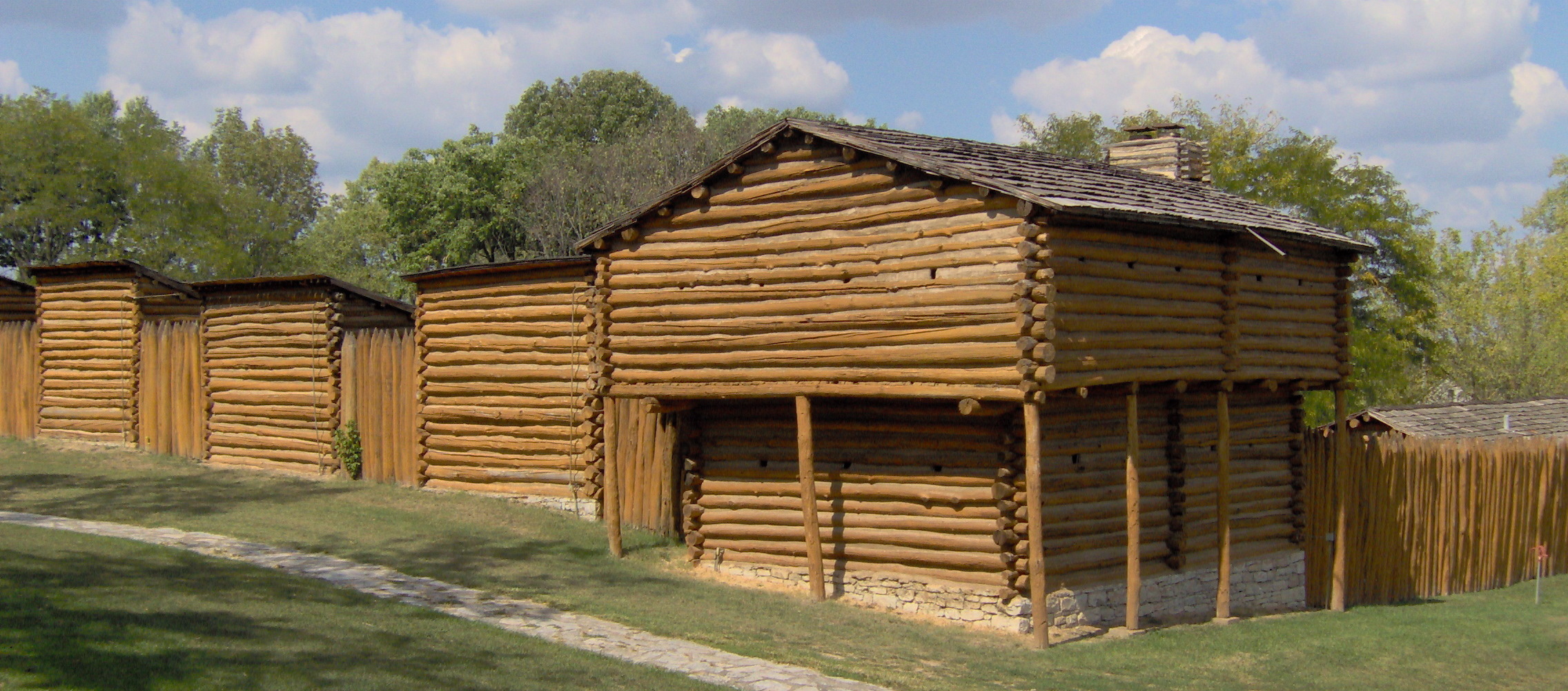
The reconstruction at Old Fort Harrod State Park. Photo: Sydney and Russell Poore, 2007, CC BY-SA 3.0 .
Jane Coomes reached Fort Harrod in September 1775. Marker 1083 on the Mercer County courthouse lawn lists, among “Mercer County FIRSTS in Kentucky,” “1776 – Mrs. Jane Coomes’ school.” She taught the alphabet on paddle-shaped pine shingles. A 1777 census of the fort found nearly a third of the population under ten — the school was not a nicety.
Boonesborough was a corporate capital. Henderson’s Transylvania Company hired Daniel Boone to cut a road from the Cumberland Gap. Construction of the first fortified settlement began April 29, 1775. On May 23, under a huge elm, Henderson convened a “House of Delegates” — a homemade legislature for a colony Virginia had never approved. Virginia voided the purchase, fully by 1778. In October 1779 Virginia chartered Boonesborough as Kentucky’s first official town. Sycamore Hollow, the salt lick and springs beside the river, is why Boone stopped there. Marker 1520 is at 4375 Boonesboro Road, Richmond.
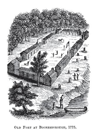
“Old Fort at Boonesborough, 1775,” from Barber and Howe, The Loyal West (1865). An artist’s idea of the palisade, not a photograph of the original walls. Public domain. (Wikimedia Commons )
Lexington was named before it existed. In early June 1775 William McConnell’s surveyors camped on a sinking spring of Elkhorn Creek, today’s McConnell Springs. News arrived of the April 19 fight at Lexington, Massachusetts. They named the camp for that battle and went home. Permanent settlement waited four years. About mid-April 1779, Colonel Robert Patterson and twenty-five men from Fort Harrod built a blockhouse at present Main and Mill. The springs chose the site. The Revolution chose the name. Marker 554 is at the entrance to McConnell Springs Drive.
Louisville sat at a choke point. The Falls of the Ohio — two miles of limestone rapids with about a 26-foot drop — were the great obstacle on the river. Whoever sat at the portage owned the west. George Rogers Clark landed on Dunmore’s Island on May 27, 1778, renamed it Corn Island, planted corn, and left civilians there when he slipped off to take Kaskaskia. In 1779 the settlers moved to the Kentucky shore. Virginia chartered Louisville on May 1, 1780, named for Louis XVI. The city is still there because boats could not ignore the falls.
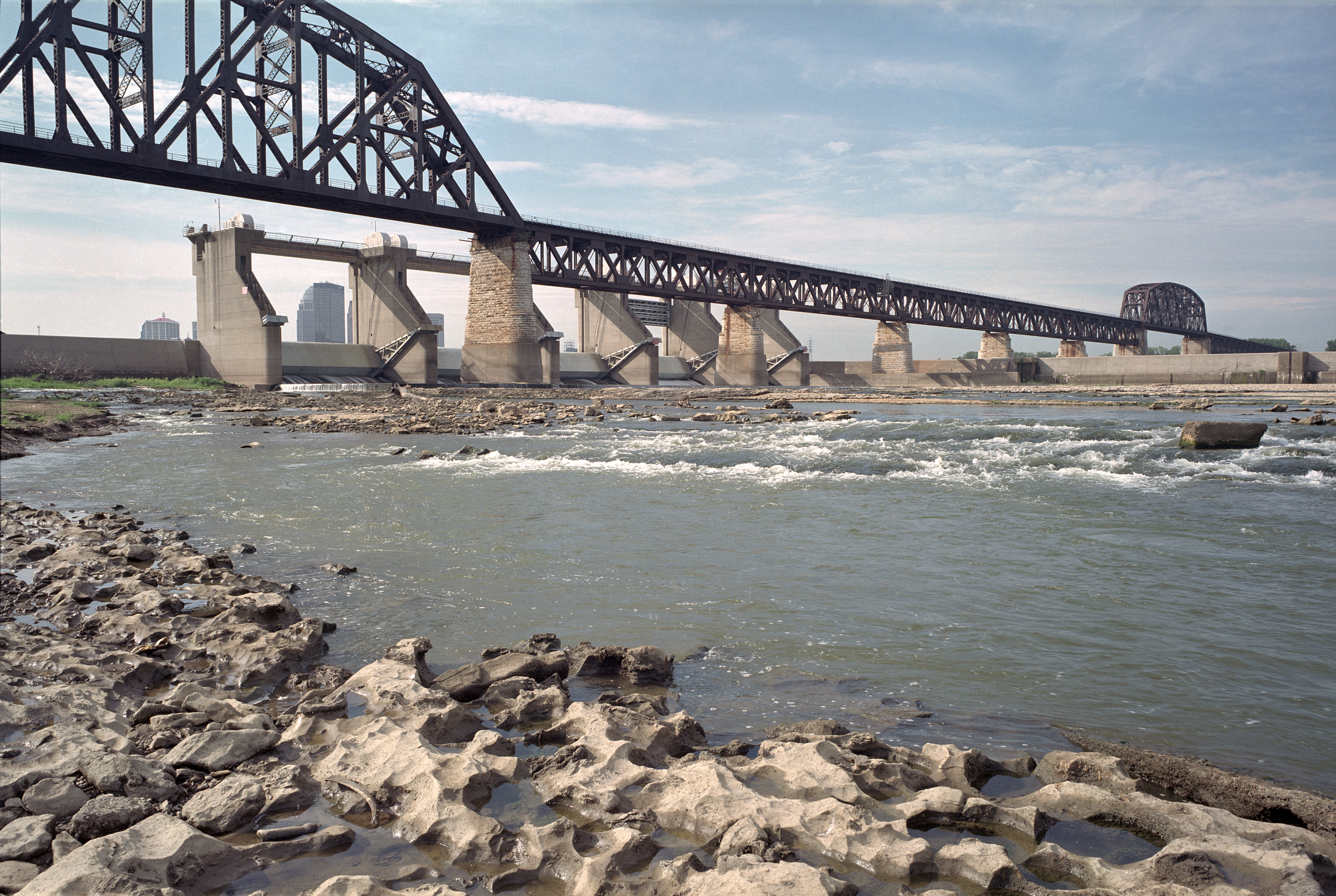
Looking south from the Falls of the Ohio. Photo: William Alden, 2005, CC BY-SA 4.0 .
Frankfort is the smaller surprise. The site was a buffalo-trail ford in an S-curve of the Kentucky River. In 1780 a party from Bryan Station, heading to make salt at Mann’s Lick, was attacked at the crossing. Pioneer Stephen Frank was killed. People started calling it Frank’s Ford. In 1786 the Virginia legislature made 100 acres of General James Wilkinson’s land the town of Frankfort. In December 1792, the new state picked it as capital. Kentucky’s capital is named for a man who died on the way to a salt lick, on a ford the buffalo had already chosen. Marker 105 is near the cemetery on East Main.
A Saturday morning in Shelby County
Best first stop: thirty to forty-five minutes on foot around the old courthouse lawn at 5th and Main (U.S. 60), Shelbyville. Then north on KY 55 to Pioneer Station / Painted Stone, then west on U.S. 60 through Simpsonville — Old Stone Inn and Capt. Simpson. Parking is easiest on the courthouse square and Washington Street.
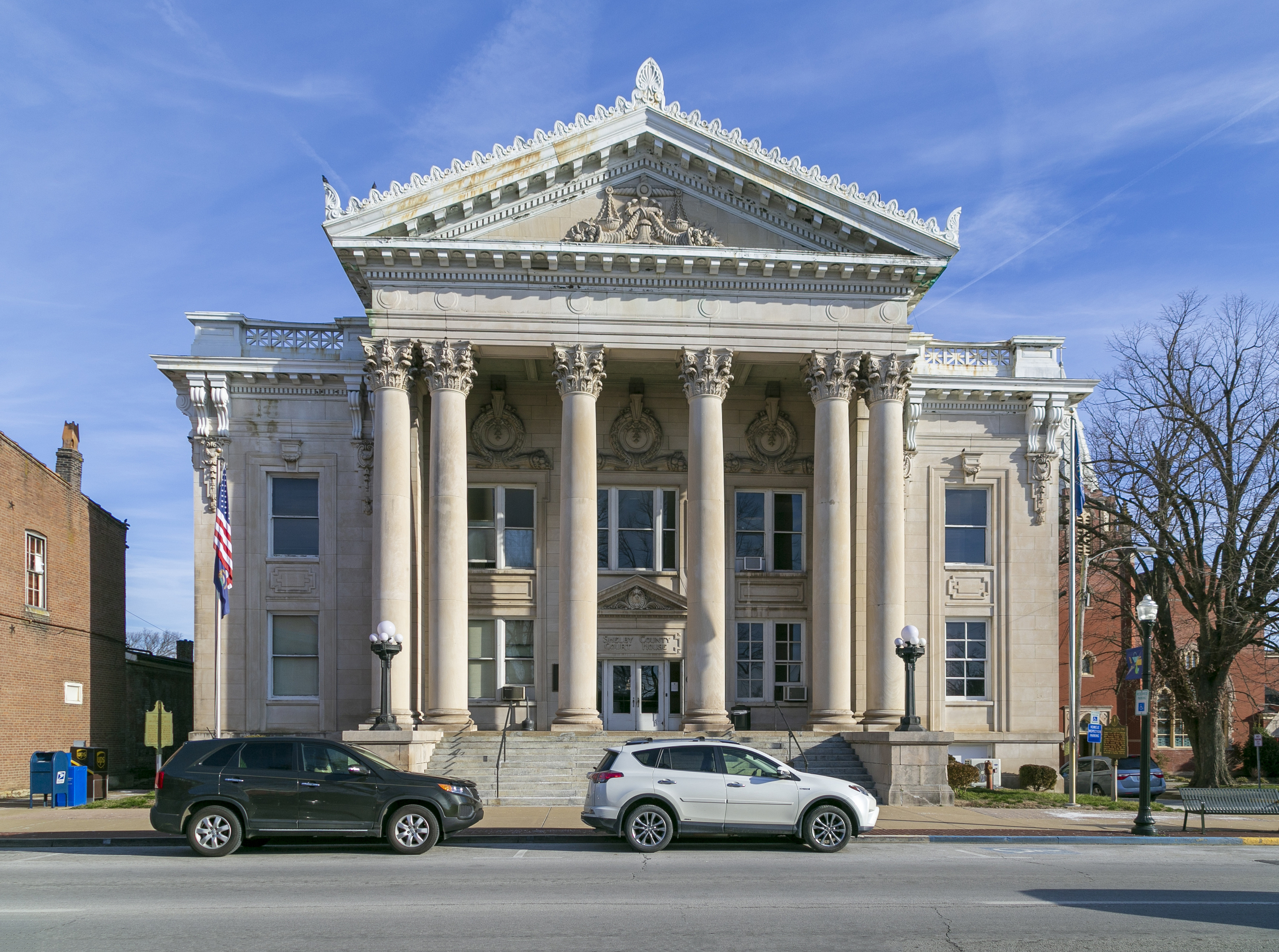
The 1913 courthouse at 5th and Main. This is the lawn. Photo: Christopher L. Riley, March 1, 2020, CC BY-SA 4.0 .
In the summer of 1775, while his brother Daniel was cutting the Wilderness Road toward Boonesborough, Squire Boone walked this ground. He came back in the spring of 1776, planted corn, and carved his name and the date on a stone by Clear Creek, then painted the letters red. The place took the name Painted Stone. By late 1779 or spring 1780 he had raised a station about two miles north of today’s Shelbyville — for nearly two years the only large station on the Wilderness Road between Harrodsburg and the Falls of the Ohio.
Kentucky became a state on June 1, 1792. On June 28, Governor Isaac Shelby approved a new county cut from Jefferson County, named for him. Capt. William Shannon gave a good spring, one acre for public buildings, and fifty acres to lot out a town. In October 1792 the first county court met and Shelbyville was established on the west bank of Clear Creek. Isaac Shelby, born December 11, 1750, near Hagerstown, Maryland, had fought at King’s Mountain and thrown himself into the Danville conventions that peeled Kentucky off Virginia. Electors chose him unanimously as the first governor. That same month he signed this county into being.
Start at the square
Park at the old courthouse, 501 Main Street.
Marker 1238 — Shelby County, 1792. Courthouse lawn, 5th and Main. Formed from Jefferson County, third created after statehood, named for Isaac Shelby: first governor 1792–96, again 1812–16; Revolutionary War, Indian campaigns, War of 1812; came to Kentucky in 1783; Danville conventions 1784–92. This is the county’s birth certificate in bronze. GPS about 38.21109, −85.21585. Erected 1969. history.ky.gov · ExploreKYHistory · HMDB
Marker 28 — Squire Boone’s Station, 1779. Same lawn. “Painted Stone” 2½ miles north on Eminence Road, thence ½ mile west to the site on Clear Creek. For nearly two years the only large station on the Wilderness Road between Harrodstown and the Falls. Ground plan found among Clark’s papers. Disastrous attack 1781, then reoccupied. First improved 1775; called “Painted Stone Tract” 1776. The oldest numbered KY marker in the county. It points you from the square out to the actual site (see 848). HMDB says this plate was erected in 1937 by the National Society of the Colonial Dames of America in the Commonwealth of Kentucky, and it is still carried as official KY marker 28. Both can be true for early-series markers. The station site is north of town, not at this corner. history.ky.gov · HMDB
Marker 1089 — The Blockhouse / Martin’s Raid. Same intersection. Built in 1858 by townspeople for civil defense against guerrillas, in the middle of this intersection, 12 by 18 feet with loopholes on all sides, manned when the alarm sounded, torn down in 1870. Reverse: August 1864, Capt. David (Black Dave) Martin tried to raid the courthouse for guns stored there. Thomas C. McGrath, merchant, J. H. Masonheimer, tailor, and others defended the town. Three guerrillas were killed, McGrath wounded. Mission failed. Martin died in 1896 and was buried in Grove Hill Cemetery. You are standing in the gun slit’s field of fire. Erected 1967. history.ky.gov · HMDB
Marker 1379 — Shelbyville Fountain. Beside the fountain itself. Purchased jointly in 1895 by city and county from J. L. Mott Iron Works, New York. Erected at Fifth and Main upon completion of Shelbyville’s first public water works. Moved in 1914 to the public square to clear the street after construction of the new courthouse. Figure on top is the “Atlantis” pattern. The 1913 courthouse, the fountain, and the 1792 county marker sit in one photograph — waterworks, Gilded Age iron, and county government stacked on the same lawn. A later fountain plaque records a 1992 restoration for the bicentennial. That restoration plaque is not a numbered KY highway marker. HMDB
Marker 2214 — Lewis and Clark in Kentucky — 1806 Return of Expedition & Death of Meriwether Lewis. Main east of 5th, west of the Shelby County Judicial Center, about 421 Main. Meriwether Lewis and William Clark visited Shelbyville several times. In November 1806, on the Expedition’s return, Lewis arrived with Expedition veterans and Mandan and Osage Indian delegations bound for Washington. Reverse: on October 28, 1809, in Shelbyville, Clark learned of Lewis’s death. He had stopped in town traveling east and read a newspaper report that Lewis had killed himself in Tennessee. The Corps of Discovery’s homecoming and the news of Lewis’s death both passed through this town, two years apart. Dedicated October 1, 2006. The official database text has a couple of typos (“journety,” “Meriwaether”). The physical plate may or may not match. HMDB
Marker 1129 — The Armstrong Hotel. Two blocks west, 6th and Main, about 602 Main. Established in 1859 by George A. Armstrong, known for food and lodgings. Guerrilla leader Ed Terrell stopped here briefly May 26, 1866, and was mortally wounded nearby trying to escape. Brig. Gen. Henry H. Denhardt was slain here September 20, 1937. The hotel burned February 7, 1944, and was not rebuilt. Two violent deaths, a guerrilla’s last stop, and a fire. The building is gone. The marker is the site. I have not field-checked whether the post is still standing. HMDB still lists it as present. Erected 1978. HMDB
While you are on the lawn, look at Shannon’s founder plaque and the DAR tablet. Neither is a numbered KHS highway marker. Shannon donated the county-seat land in 1792. The DAR tablet is the Isaac Shelby Chapter’s Revolutionary soldiers memorial.
Two blocks off the square, if you have the walk: Marker 971 , Science Hill School, 525 Washington. In 1825 Julia Tevis opened a girls’ academy that taught chemistry and Latin instead of embroidery. Wakefield-Scearce Galleries occupy the campus now, so you can walk the grounds.
North to Painted Stone
Marker 848 — Pioneer Station / Squire Boone. KY 55 (Eminence Pike), about two miles north of Shelbyville. Address given: 2766 Eminence Pike. Squire Boone’s Station or Painted Stone, half mile west on Clear Creek. Founded by Squire Boone and others, 1779. This is the closest official marker to the actual Painted Stone ground. The station site is private land. The 1776 painted stone itself is not a public exhibit. history.ky.gov · HMDB
West on U.S. 60
Marker 1088 — Maj. Bland W. Ballard / Tick Creek Massacre. U.S. 60 at Cross Keys Road, west of downtown. Hunter, Indian fighter, and scout for George Rogers Clark. Reverse: near Tyler Station, three miles north, Bland Ballard, his wife, and three children were massacred at Ballard’s cabin on Tick Creek in October 1788. His son, Maj. Bland W. Ballard, survived. Ballard is the same scout who warned Painted Stone before the 1781 Long Run Massacre. history.ky.gov
Marker 1889 — Old Stone Inn. U.S. 60, Simpsonville, west of Buck Creek Road (KY 1848). About 6905 Shelbyville Road. This structure on the Midland Trail has been a tavern, stagecoach inn, and home since the early 1800s, erected from stone quarried nearby. Oldest stone residence in Shelby County still standing and occupied. After years as a private home, Old Stone Inn opened as a restaurant in 1922. ExploreKYHistory dates construction from 1817. Erected 1991. NRHP 76000944. ExploreKYHistory · HMDB
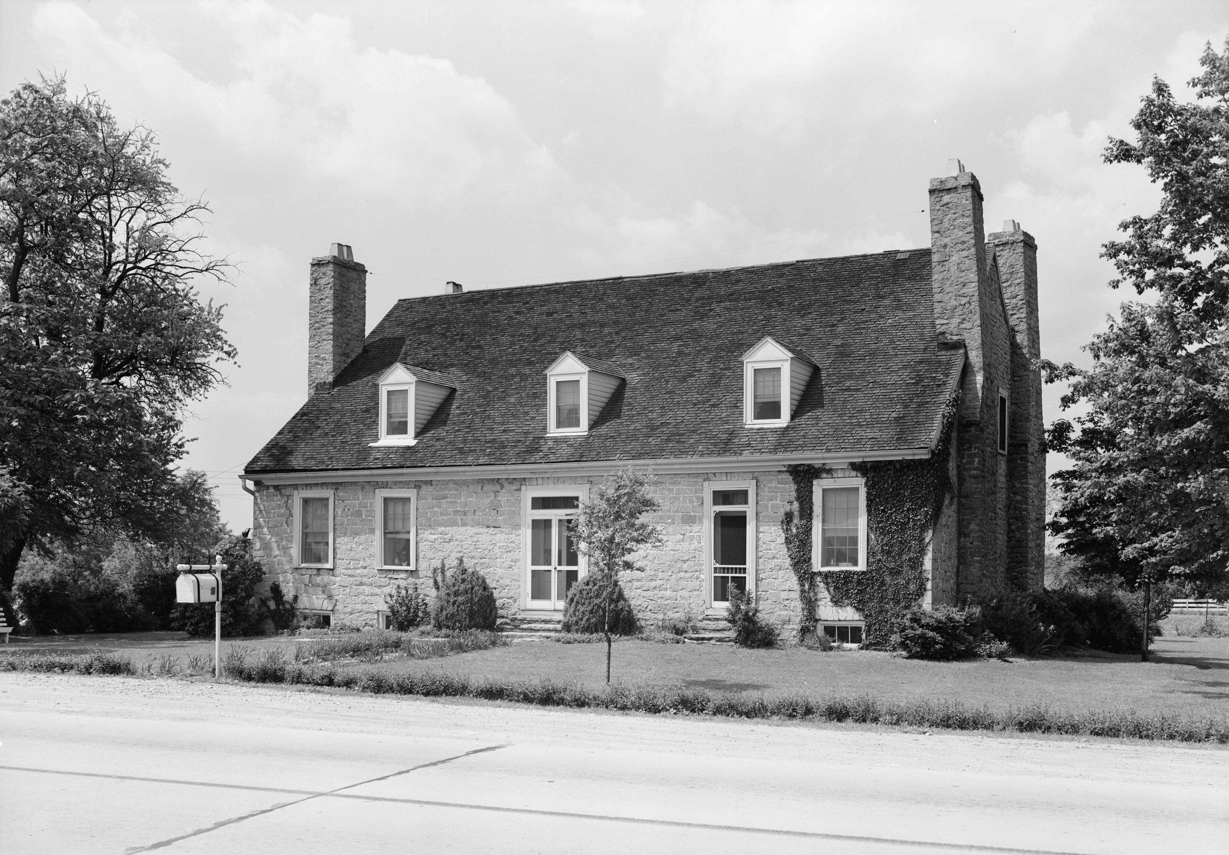
Old Stone Inn, Simpsonville. Lester Jones, Historic American Buildings Survey, June 2, 1940. Library of Congress. Public domain. (Wikimedia )
Marker 1128 — Capt. John Simpson. U.S. 60, Simpsonville, about 300 feet from Old Stone Inn. Simpsonville and Simpson County were named for the captain who fought with Wayne at Fallen Timbers, practiced law in Shelbyville, and was elected to the State Legislature four times. Elected to Congress in 1812. He and another Shelby Countian, Col. John Allen, raised a company of riflemen in the War of 1812. Both killed at the Battle of the River Raisin. The town’s namesake never saw Congress. Erected 1968. history.ky.gov · HMDB
If I only see four
The outing I would actually take on a Saturday morning is about three hours.
- Park at the old courthouse, 501 Main. Read 1238 (county 1792), 28 (Painted Stone), 1089 (blockhouse), 1379 (fountain), 2214 (Lewis and Clark). Look at Shannon’s founder plaque and the DAR tablet while I am there.
- Drive KY 55 north about two miles to 848 Pioneer Station, 2766 Eminence Pike. That is as close as the state puts you to Painted Stone.
- Drive U.S. 60 west to Simpsonville: 1889 Old Stone Inn and 1128 Capt. Simpson on the same block.
If I only see four markers in this county, I would make them 1238, 28, 848, and 1889.
The database I used is the Kentucky Historical Marker Database . The program page is at history.ky.gov . ExploreKYHistory is explorekyhistory.ky.gov .
The green plates around here are not the whole story. They are a 125-word door. Behind them: a town on the Warrior’s Path that was gone before Boone looked out from Pilot Knob; dogs buried with their people on the Green River; a capital named for a man killed on the way to a salt lick. The ground was never empty. It still isn’t.